
The Great Raft on the Red River blocked any attempt to use the river for navigation. The Raft was a logjam hundreds of years in the making that blocked any boat traffic on the Red River in northwestern Louisiana. In the mid-18th century, a riverboat captain and inventor figured out how to clear the colossal mess.
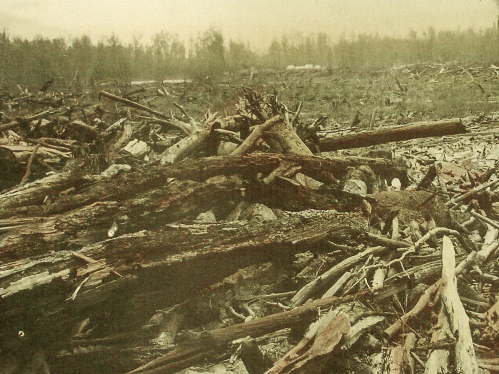
During Louisiana’s early history, the Red River between Shreveport and Natchitoches was clogged with a logjam so immense it was known as the ‘Great Raft’. Those logs were sometimes dozens of feet deep and even had plants and trees growing on top of them. The Red River stretches more than 1,300 miles from its headwaters in New Mexico, following the border of Oklahoma and Texas, then entering the far northwest corner of Louisiana on its way to the Mississippi River. “The Red River is kind of that western river where you have flash floods,” explains Michael Mumaugh of the Cane River Heritage area near Alexandria. “Dead trees wash out, they log jam. And then once the jam’s created, year after year more logs run into it.” Mumaugh adds.
clearing the logjam
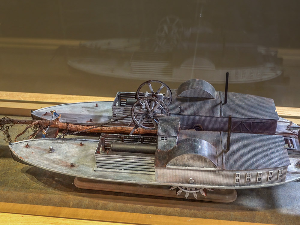
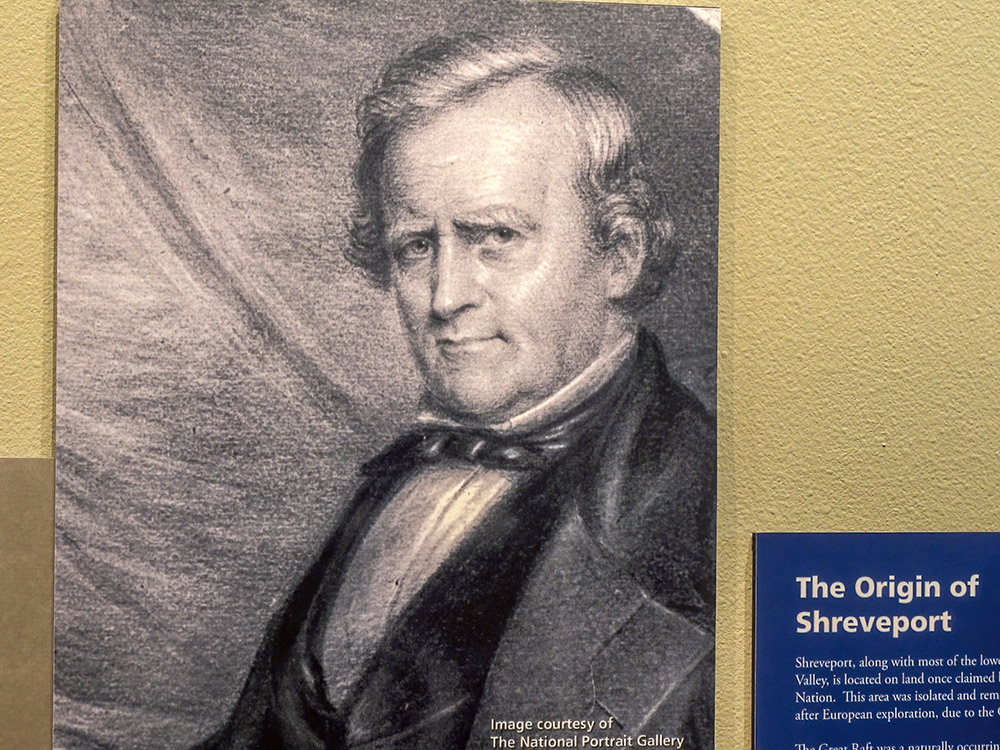
By the 1830’s the Great Raft was 175 miles long. The logjam caused the river to spill into neighboring lowlands and created several Louisiana lakes that remain today. Those lakes include Lake Bistineau southeast of Shreveport, which is now a Louisiana State Park. Steamboat captain and inventor Henry Shreve came up with a solution, a ‘snag boat’. There are photographs and a model of the Shreve-designed boat at the J. Bennett Johnston Waterway Regional Visitors Center in downtown Shreveport. “He would attach a chain to one of the logs and crews of people would cut the branches and roots off anything that would snag,” explained Joseph Holoubek of the Corps of Engineers. The work was mostly done by hand. Holoubek added, “They started in 1833 and they finished here in Shreveport in 1838.”
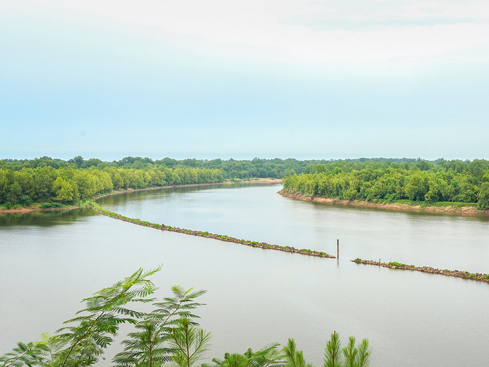
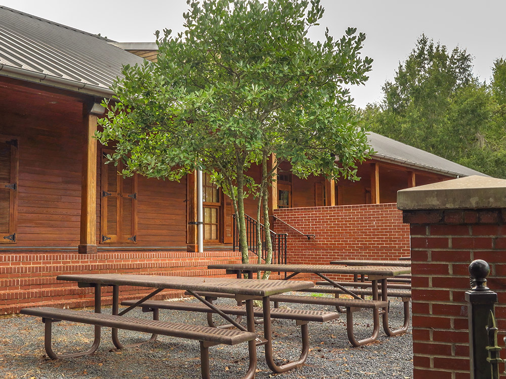
The Cane River National Heritage Visitors Center at Grand Ecore offers a high overlook of the Red River. The center is 75 miles southeast of Shreveport. Museum manager Michael Mumaugh explains that the work by Shreve, “does open up navigable waterway all the way to what becomes Shreveport and beyond,” into eastern Texas and southern Arkansas.
Visitors to the Grand Ecore center can picnic atop the high river bluff. Both Union and Confederate forces used the location during the Civil War. “Forts are built nearby here on top of the cliff,” Mumaugh tells me. “It controls a bend in the river which would slow any boat traffic coming up or down.”
the red river today
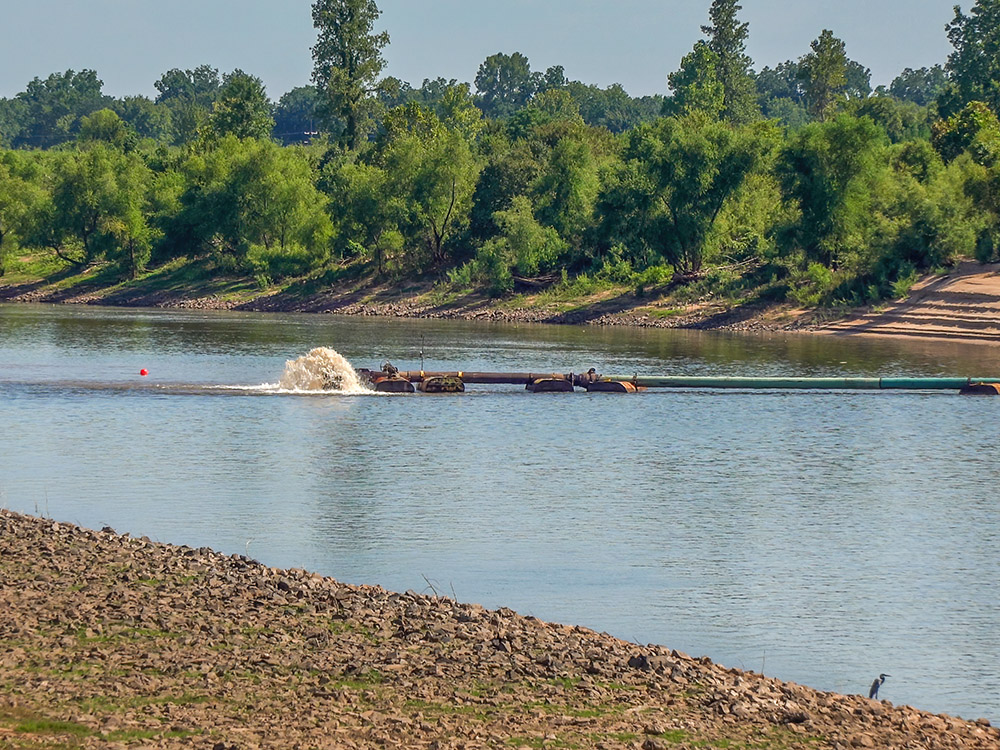
Congress ignored Shreve’s recommendation to maintain the cleared river channel. A second raft formed, which forced a second clearing in the 1870’s. Today, the Army Corps of Engineers operates a series of four locks and dams on the Red River.
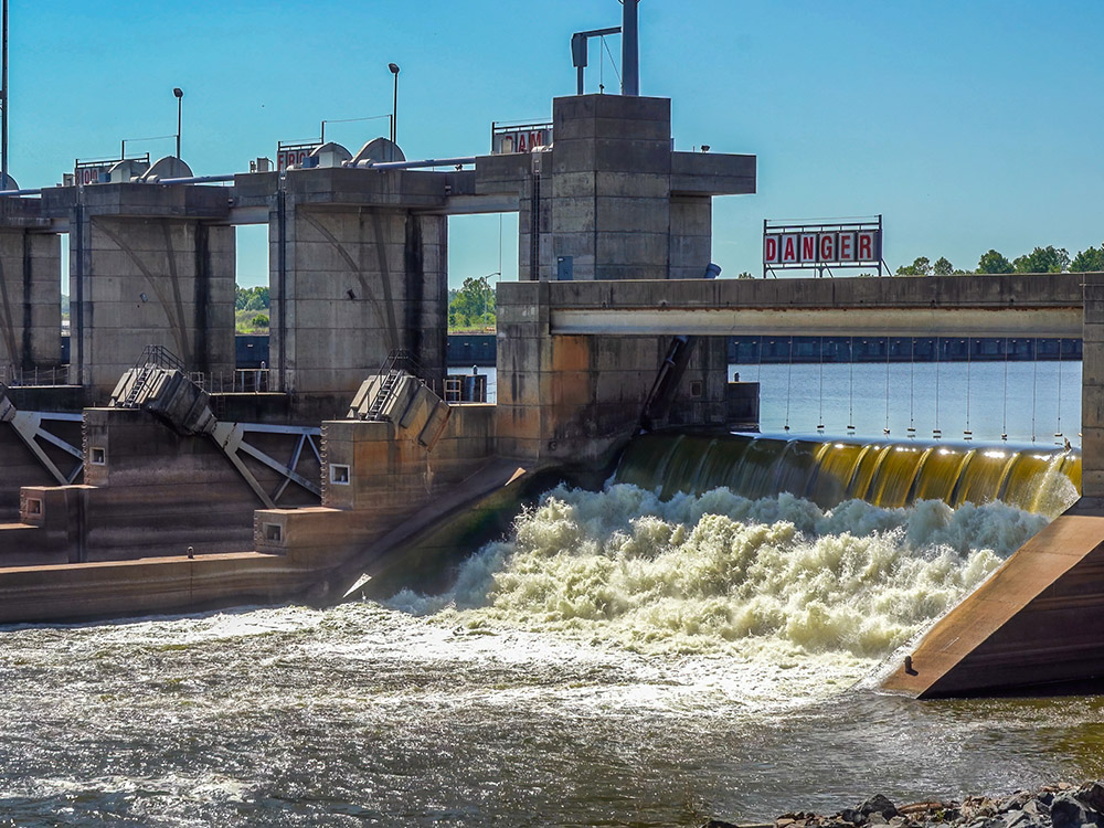
Regular dredging keeps the river channel at a depth of nine feet by 200 feet wide. That allows barge traffic to navigate the waterway that was once unusable due to the Great Red River Raft.
the red river raft featured on tv
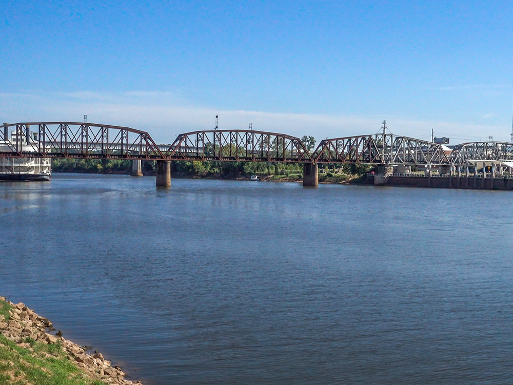
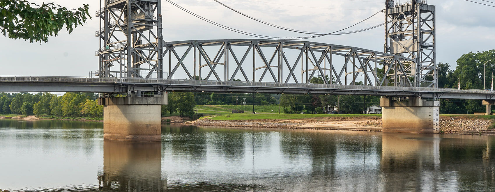
Railroad and highway bridges cross the Red River between Shreveport and Bossier City, LA
Getting there
The J. Bennett Johnston Waterway Regional Center is located near the Red River in downtown Shreveport. 700 Clyde Fant Parkway, Shreveport, LA. Phone: (318) 677-2673.
The Grand Ecore Visitor Center is located on the Red River north of Natchitoches, LA. 106 Tauzin Island Road Natchitoches, LA. Phone: (318) 354-8770.
700 Clyde Fant Memorial Pkwy, Shreveport, LA 71101
Tauzin Island Rd, Louisiana 71457

Leave a Reply